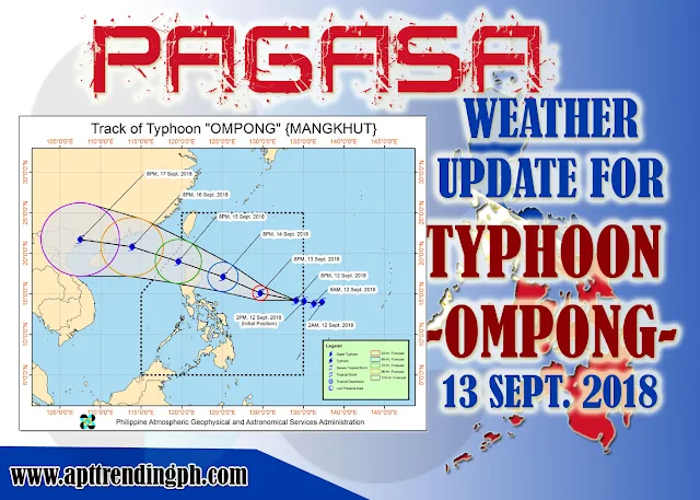
FOR:Typhoon Ompong
Tropical Cyclone: WARNING
ISSUED AT:11:00 AM, 13 September 2018
TYPHOON "OMPONG" HAS SLIGHTLY SLOWED DOWN AS IT CONTINUES TO MOVE WESTWARD OVER THE PHILIPPINE SEA.
Typhoon "Ompong" continues to threaten Northern Luzon. Occasional rains and gusty winds will be experienced over the areas under TCWS #1. TY "OMPONG" is expected to make landfall in the northern Cagayan on Saturday morning (September 15). Fisherfolks and those with small seacrafts are advised not to venture out over the seaboards of areas under TCWS #1, the northern seaboard of Northern Luzon and the eastern seaboards of Visayas and of Mindanao.Location of eye/center: At 10:00 AM today, the eye of Typhoon "OMPONG" was located based on all available data at 725 km East of Virac, Catanduanes (14.5 °N, 130.9 °E)
Strength: Maximum sustained winds of 205 km/h near the center and gustiness of up to 255 km/h
Forecast Movement: Moving West at 20 km/h
Forecast Positions:
- 24 Hour(Tomorrow morning): 615 km East of Baler, Aurora(15.9°N, 127.3°E)
- 48 Hour(Saturday morning):In the vicinity of Lasam, Cagayan(18.1°N, 121.5°E)
- 72 Hour(Sunday morning): 610 km West of Basco, Batanes (OUTSIDE PAR)(19.6°N, 116.2°E)
- 96 Hour(Monday morning):1,270 km West of Basco, Batanes (OUTSIDE PAR)(20.9°N, 109.8°E)
- 120 Hour(Tuesday morning):2,045 km West of Basco, Batanes (OUTSIDE PAR)(21.2°N, 102.3°E)
TROPICAL CYCLONE WARNING SIGNAL:
#1 (30-60kph expected in 36 hrs)
Batanes, Cagayan including Babuyan group of Islands, Apayao, Abra, Kalinga, Mountain Province, Ifugao, Isabela, Benguet, Quirino, Nueva Vizcaya, Aurora, Nueva Ecija, Bulacan, Rizal, Laguna, Quezon inc. Polillo Island, Camarines Norte, Camarines Sur, Catanduanes, Albay, Sorsogon, Burias and Ticao island, Northern Samar.
Weather Information is courtesy of DOST PAGASA.


No comments:
Post a Comment